
Find Latitude Longitude Coordinates Google Mpas Exactly: A Simple Guide
.jpg)
In our increasingly connected world, pinpointing a precise location is more than just a convenience; it's often a necessity. Whether you're a traveler marking a hidden gem, a developer integrating location data into an application, a researcher gathering field data, or simply someone trying to share an exact spot with a friend, knowing how to obtain accurate geographic coordinates is an invaluable skill.
Google Maps, with its ubiquitous presence and powerful mapping capabilities, offers a remarkably simple way to achieve this. Over 2 billion people use Google Maps monthly worldwide as of 2026, [WiserReview, 2026], making it the dominant force in navigation apps with a 67% market share in 2026 [KeyStar Agency, 2026].
This guide will walk you through the straightforward methods for extracting exact latitude and longitude coordinates from Google Maps, transforming how you interact with and understand geographic information.
The Power of Exact Location Data
Latitude and longitude form a coordinate grid system, allowing any point on Earth to be specified by a unique pair of numbers.
The ability to identify a specific point on Earth with precision unlocks a multitude of possibilities. Latitude and longitude, collectively known as coordinates, form a global grid system that allows for unambiguous identification of any location.
This data is the bedrock of modern navigation, logistics, urban planning, and countless other fields. Understanding how to access these coordinates empowers you to leverage this fundamental geographic information effectively.
What You'll Learn in This Guide
This Leads Sniper guide is designed to be comprehensive yet concise. You will learn the essential concepts behind latitude and longitude, discover the different formats in which coordinates are presented, and master the step-by-step processes for retrieving these vital pieces of information from Google Maps on both desktop computers and mobile devices. We will also touch upon tips for enhancing accuracy and explore why this information is so critical in various real-world scenarios.
Why Exact Latitude and Longitude Matter
While a street address often suffices for daily navigation, it frequently lacks the specificity required for many applications. Exact latitude and longitude provide a universal language for location, overcoming the limitations of human-readable addresses.
Real-World Applications for GPS Coordinates
The demand for precise location data fuels a rapidly growing industry. The global geospatial analytics market size was valued at USD 92.19 billion in 2024 and is projected to reach approximately USD 338.78 billion by 2034 [Precedence Research, 2025]. This growth underscores the immense value placed on accurate positioning. For businesses and individuals alike, GPS coordinates are essential for:
- Navigation and Logistics: Guiding delivery vehicles, optimizing shipping routes, and providing precise directions for autonomous systems.
- Data Management: Creating accurate geographic databases, geocoding customer addresses, and mapping assets.
- Environmental Monitoring: Tracking wildlife, monitoring deforestation, and recording sampling locations for scientific research.
- Emergency Services: Dispatching first responders to exact incident locations, especially in areas with poor addressing.
- Personal Use: Marking precise meeting points, sharing adventurous locations, or using in GPS-enabled devices for hiking and geocaching.
When Google Maps Addresses Aren't Enough
Addresses can be ambiguous, especially in rural areas, rapidly developing urban zones, or when referring to specific points within a large property like a park or a construction site. A building might have multiple entrances, or a point of interest might not have a designated street number.
In such cases, a simple address fails to convey the exact spot. Latitude and longitude, however, pinpoint a single, unique coordinate on the Earth's surface, leaving no room for interpretation.
Enhancing Data Accuracy and Planning
In fields like surveying, agriculture, and infrastructure development, precision is paramount. Using exact latitude and longitude ensures that data is collected and analyzed accurately. This leads to better planning, more efficient resource allocation, and improved outcomes.
For instance, precision agriculture relies on GPS coordinates to apply fertilizers or irrigation to specific zones within a field, optimizing yield and minimizing waste. The location data as a service market itself is expected to grow from $2.34 billion in 2024 to $2.82 billion in 2025, reflecting the economic importance of this data [Location Data as a Service Global Market Report, 2025].
Demystifying Latitude and Longitude
At its core, the global positioning system relies on a spherical coordinate system to define locations on Earth. Understanding the basics of this grid is key to appreciating the significance of latitude and longitude.
Understanding the Global Grid System
Imagine the Earth as a sphere. To map any point on its surface, we use a system of imaginary lines. These lines form a grid, with two primary components: latitude and longitude. This system allows us to assign a unique pair of numbers to every point on the planet.
Latitude: North-South Positioning on the Earth
Latitude measures a location's distance north or south of the Equator. The Equator itself is designated as 0° latitude. Lines of latitude, also known as parallels, run east-west. They increase in value as you move towards the North or South Pole.
- Northern Hemisphere: Latitude values range from 0° at the Equator to 90° North at the North Pole.
- Southern Hemisphere: Latitude values range from 0° at the Equator to 90° South at the South Pole.
Longitude: East-West Positioning on the Earth
Longitude measures a location's distance east or west of the Prime Meridian. The Prime Meridian, which passes through Greenwich, London, is designated as 0° longitude. Lines of longitude, also known as meridians, run north-south. They increase in value as you move away from the Prime Meridian.
- Eastern Hemisphere: Longitude values range from 0° at the Prime Meridian to 180° East.
- Western Hemisphere: Longitude values range from 0° at the Prime Meridian to 180° West.
The 180° meridian, also known as the International Date Line, is antipodal to the Prime Meridian.
Common Coordinate Formats: Focus on Decimal Degrees
While latitude and longitude can be expressed in several formats, Decimal Degrees (DD) is the most common and user-friendly for digital applications.
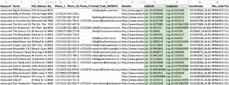
- Decimal Degrees (DD): This format represents the entire location as two decimal numbers. Latitude values are typically positive for the Northern Hemisphere and negative for the Southern Hemisphere. Longitude values are positive for the Eastern Hemisphere and negative for the Western Hemisphere. For example, the Eiffel Tower is approximately 48.8584° N, 2.2945° E, often written as 48.8584, 2.2945. Google Maps predominantly displays coordinates in this decimal format.
- Degrees, Minutes, and Seconds (DMS): This is a more traditional format, dividing degrees into 60 minutes ('), and each minute into 60 seconds ("). For example, the Eiffel Tower in DMS format is approximately 48°51'29.1" N 2°17'39.0" E. While useful for some specialized applications, DD is generally preferred for its simplicity in digital contexts and is the primary output from Google Maps.
Getting Coordinates on Google Maps: Desktop Browser
Accessing latitude and longitude on Google Maps via a desktop browser is incredibly straightforward, primarily utilizing a simple right-click action. It's estimated that around 73% of websites and businesses in the U.S. use the Leads Sniper for their navigation and geographic data capabilities in 2024 [ElectroIQ, 2025].
Step-by-Step: The Right-Click Method
This is the most direct way to get coordinates for any visible point on the map.
- Open Google Maps: Navigate to maps.google.com in your web browser.
- Locate Your Desired Point: Use the search bar to find a specific address, landmark, or simply pan and zoom to the general area you're interested in.
- Right-Click: Position your cursor precisely over the desired location on the map and perform a right-click.
- Observe the Pop-Up: A context-sensitive pop-up menu will appear. Near the top of this menu, you will see a pair of numbers, separated by a comma. This is your latitude and longitude in decimal degrees.
Locating an Address or Point of Interest
If you have a known address or the name of a place (e.g., "Eiffel Tower" or "1600 Amphitheatre Parkway"), you can enter it into the search bar. Once the pin appears on the map, simply right-click on that pin to instantly retrieve its coordinates.
Dropping a Pin for Unaddressed Locations
For locations that don't have a readily identifiable address, or if you need to pinpoint a very specific spot (like a tree, a hiking trail junction, or a specific point on a large property), you can manually drop a pin.
- Pan and Zoom: Navigate to the exact spot on the map.
- Left-Click and Hold (or sometimes just a left-click): Depending on your browser and map settings, a left-click on an empty area will often drop a red pin.
- Right-Click the Dropped Pin: Once the red pin is placed, right-click on it. The coordinates will appear in the pop-up menu, associated with the general area where you dropped the pin.
Extracting Coordinates from the Pop-Up Window
The pop-up window that appears after a right-click is the key to extracting the coordinate data. The top line of this pop-up will display the latitude and longitude in decimal format, e.g., 48.8584, 2.2945.
Copying Coordinates to Your Clipboard
Once the coordinates are visible in the pop-up window, they are usually automatically selected or easily selectable with your mouse. You can then copy them directly to your clipboard using your browser's standard copy command (Ctrl+C on Windows, Cmd+C on Mac). This allows you to paste the coordinates into documents, spreadsheets, or other applications seamlessly.
Understanding the Latitude and Longitude Format Displayed
As mentioned, Google Maps primarily displays coordinates in the Decimal Degrees (DD) format. The first number is always the latitude, and the second is the longitude. Positive values typically indicate North and East respectively, while negative values indicate South and West. For example, -33.8688, 151.2093 represents a location in Sydney, Australia (latitude south of the Equator, longitude east of the Prime Meridian).
Getting Coordinates on Google Maps: Mobile Devices (Android & iOS)
The process for retrieving latitude and longitude on mobile devices is slightly different but equally intuitive, primarily using a long-press (tap and hold) action. These instructions generally apply to both Android and iOS devices, including tablets.
General Steps for Mobile (Android & iPhone/iPad)
The core functionality is consistent across major mobile operating systems.
- Open the Google Maps App: Launch the Google Maps application on your smartphone or tablet.
- Find Your Location: Use the search bar at the top to find an address, place, or simply pan and zoom to the desired area on the map.
Using the Search Bar to Find a Location
Similar to the desktop experience, you can type in an address, business name, or landmark into the search bar. Once Google Maps displays the location with a pin, you can proceed to the next step.
Long-Press (Tap and Hold) to Drop a Pin
For any visible spot on the map, whether it's marked by a search result or just an empty area:
- Tap and Hold: Press and hold your finger on the exact spot on the map you want to get the coordinates for.
- Red Pin Appears: A red pin will drop at that location, and an information window (infowindow) will appear at the bottom of the screen.
Accessing Coordinates from the Dropped Red Pin (Infowindow)
The infowindow at the bottom of the screen is where you'll find the coordinates. The latitude and longitude are displayed prominently at the very top of this infowindow, again in decimal degree format, e.g., 48.8584, 2.2945.
Copying the GPS Location to Your Device's Clipboard
To easily use these coordinates elsewhere, you can copy them.
- Tap the Coordinates: In the infowindow at the bottom, tap directly on the displayed latitude and longitude coordinates.
- Confirmation: This action typically copies the coordinates to your device's clipboard. You may see a brief confirmation message indicating that the location has been copied. You can then paste this information into messages, notes, or other apps.
Advanced Tips for Precision and Troubleshooting
.jpg)
While the basic methods are straightforward, a few extra tips can help you ensure accuracy and overcome common challenges.
Zooming In for Unprecedented Accuracy
The finer your zoom level, the more precise your selection will be. When accuracy is critical, zoom in as close as possible to the exact feature you want to mark. Use satellite view for even greater detail, allowing you to identify specific objects like a particular building entrance, a specific marker, or even a unique terrain feature.
What to Do If the Pin Drops in the Wrong Spot
It's possible to accidentally drop a pin slightly off your intended mark, especially on a mobile device. If this happens:
- On Mobile: Simply tap the red pin itself. This usually dismisses it and allows you to tap and hold again on the correct spot. Alternatively, you can drag the red pin to a new location.
- On Desktop: The dropped pin can usually be removed by clicking the 'X' in the pop-up window. You can then right-click again on the correct location.
Handling Ambiguous Locations and Multiple Pins
In dense urban areas or on complex sites, multiple points of interest might be clustered together. If you right-click or long-press in such an area, Google Maps might display a list of nearby places in the pop-up/infowindow. Ensure you select the correct location from this list before noting or copying the associated coordinates. If you're trying to mark an unaddressed spot, zoom in extremely close and ensure your cursor or finger is precisely centered on your target.
Leveraging Google Maps for Location Data
Google Maps isn't just a navigation tool; it's a powerful platform for data acquisition. Its widespread adoption means that the coordinates obtained from it are compatible with a vast ecosystem of applications and services.
The global location-based services (LBS) market was valued at USD 60.01 billion in 2024 and is anticipated to grow significantly [Polaris Market Research, 2025]. This growth highlights the critical role that accurate location data, easily obtained via tools like Google Maps, plays in modern economies.
Future Trends in Location Data and Mapping
The field of location-based services is continuously evolving. With advancements in GNSS (Global Navigation Satellite System) and RTK (Real-Time Kinematic) precision, location accuracy is improving. Standard GPS Signal-in-Space Error (SISRE) has dropped to approximately 30 cm (RMS) for dual-frequency receivers in 2024 [GlobeNewswire, 2025], enabling even more precise applications.
Location-based services are projected to grow at a high CAGR of 17.80% during the forecast period (2024-2032) [Fortune Business Insights, 2026], indicating an increasing reliance on and development of technologies that utilize geographic coordinates.
Conclusion
Mastering the ability to extract exact latitude and longitude from Google Maps is a fundamental digital skill in today's world. Whether you're using a desktop browser or a mobile device, the process is remarkably intuitive, primarily involving a right-click or a tap-and-hold. This precise location data is the backbone of countless applications, from professional geographic analysis and business operations to personal travel and communication.
By understanding the underlying principles of latitude and longitude, and by employing the straightforward methods outlined in this guide, you are well-equipped to leverage the power of precise location information for any purpose. As technology advances, the importance of accurate mapping and location data will only continue to grow, making this skill increasingly valuable.


